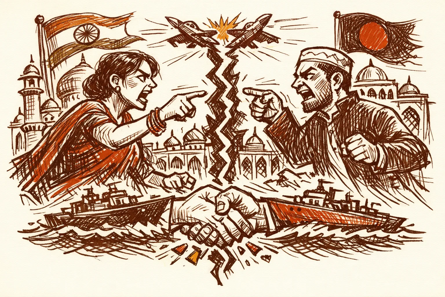
What Just Happened
Muhammad Yunus, head of Bangladesh's interim government, met Pakistan's top military general in Dhaka. He handed him a book. The book's cover showed a map with India's seven northeastern states drawn as part of Bangladesh.
Yunus posted photos of the meeting himself. On social media. Publicly.
The book, published by the July Shaheed Smriti Foundation, documents the student uprising that removed Sheikh Hasina. Its cover features artwork that mirrors the "Greater Bangladesh" map circulated by Dhaka-based Islamist group Sultanat-e-Bangla. That map includes not just the northeast but also parts of West Bengal, Assam, Tripura, and even Odisha and parts of Myanmar.
India's Ministry of External Affairs had not issued an official statement at the time of this writing.
This Is Not the First Time
New Delhi should not be surprised. A clear pattern has been building for months.
In April, Yunus traveled to China and told Chinese officials that India's seven northeastern states are "landlocked" and have "no way to reach the ocean." He described Bangladesh as the "only guardian of the ocean" for the region and invited China to treat the area as an extension of its own economy.
That same month, Yunus's close aide Nahidul Islam had already shared a "Greater Bangladesh" map on social media showing West Bengal, Tripura, and Assam as Bangladeshi territory. The post was deleted after public backlash.
Then, after the Pahalgam terror attack that killed 26 people, another Yunus appointee went further. Major General (retired) ALM Fazlur Rahman, whom the Yunus government appointed to chair the inquiry into the 2009 Bangladesh Rifles mutiny, posted on Facebook: "If India attacks Pakistan, Bangladesh should occupy seven states of Northeast India. I think it is necessary to start a discussion on a joint military system with China."
The Yunus government called those remarks "personal." But Fazlur Rahman holds a government appointment. His post was liked by a fellow commission member with ties to the Islamist student organization Islami Chhatra Shibir. And his commission was set up in December to reinvestigate the 2009 mutiny - with the stated goal of finding "foreign" involvement, widely read as a reference to India.
In December, another Yunus adviser, Mahfuz Alam, posted on Facebook that a "truncated Bangla" is "not complete victory or freedom." That post was also deleted after India's Ministry of External Affairs objected.
Four incidents in under a year is a pattern.
The Scale of What Is at Stake
Eight northeastern states - Assam, Arunachal Pradesh, Manipur, Meghalaya, Mizoram, Nagaland, Tripura, and Sikkim - are home to over 40 million people. Nearly all of their goods, supplies, and military logistics move through a single strip of land in northern West Bengal called the Siliguri Corridor, also known as the Chicken's Neck.
That corridor is around 22 kilometers wide at its narrowest point. It is flanked by Nepal, Bhutan, and Bangladesh. China's Chumbi Valley sits close to its northeast. According to geopolitical research published by the Lowy Institute, a Chinese military advance of just 130 kilometers could cut off Bhutan and all of northeast India.
Bangladesh shares a 1,596-kilometer border with India's northeast. At Lalmonirhat in northern Bangladesh, there is a former World War II airbase that Dhaka has reportedly invited China to help revitalize. That airbase sits approximately 160 kilometers from the Siliguri Corridor and 10 to 15 kilometers from the Indian border, according to The Diplomat's reporting.
A Chinese military or dual-use presence at Lalmonirhat would place assets within striking range of the only land link connecting a third of India's landmass to the mainland.
The Economic Cost of Instability
According to the India Brand Equity Foundation, total bilateral trade touched USD 13.51 billion in FY25. India exported over 5,000 commodities to Bangladesh. Bangladesh is India's biggest trading partner in the subcontinent.
The World Bank has noted that traders from Agartala in Tripura currently travel 1,600 kilometers through the Siliguri Corridor to reach Kolkata port. Through Bangladesh, the same journey could be under 450 kilometers.
India withdrew its transshipment facility for Bangladesh in April, after Yunus's China remarks. According to the Observer Research Foundation, the termination disrupted Bangladesh's third-country trade and derailed progress on the Bangladesh-Bhutan-India-Nepal corridor.
Bangladesh loses far more when relations collapse. Its readymade garment sector, which accounts for 84 percent of its exports according to The Week, depends on Indian supply chains for cotton and fabric inputs. Bangladesh also faces a 37 percent US tariff threat, already paused but unresolved.
Bangladesh needs India more than India needs Bangladesh right now. Yunus is playing a weak hand aggressively.

Who Is Behind the "Greater Bangladesh" Idea
The "Greater Bangladesh" map that appeared on the book cover was not invented this year. According to Zee News, the map was first displayed publicly at an exhibition at the University of Dhaka, promoted by an Islamist group called Sultanat-e-Bangla. The same map had appeared in the Rajya Sabha, raised by Congress MP Randeep Singh Surjewala in August.
The concept envisions Bangladesh absorbing northeast India, West Bengal, Tripura, Assam, and even parts of Myanmar's Arakan region. It is a fringe Islamist territorial fantasy with no basis in international law, history, or any bilateral agreement.
What is new is that the head of a neighboring government is now gifting books with that map on the cover to the chairman of Pakistan's Joint Chiefs of Staff.
Geostrategist Brahma Chellaney, writing in Business Today, described the pattern plainly: Yunus is presiding over a "state-backed Islamist resurgence" and using it to stoke anti-India sentiment while building a new relationship with Pakistan - the same country Bangladesh seceded from in 1971 after a brutal liberation war.
The Pakistan Factor
The general who received the book was not a junior official. General Sahir Shamshad Mirza is the chairperson of Pakistan's Joint Chiefs of Staff Committee. At the Islamabad Symposium earlier that month, Mirza had called the Indian Army "politicised" and called for third-party mediation on Kashmir - directly contradicting India's long-standing position that Kashmir is a bilateral matter.
The India-Pakistan relationship was already at its lowest point following the Pahalgam terror attack. Bangladesh's public outreach to Islamabad in this context - complete with a sovereignty-violating book cover - was not neutral diplomacy. It was a signal.
What Has Already Been Tried
India built its strongest-ever Bangladesh relationship under Modi's Neighbourhood First policy. Under Sheikh Hasina's government, India and Bangladesh signed 22 agreements. They opened five rail links. They launched the India-Bangladesh Friendship Power Company. Bangladesh allowed India to ferry goods to the northeast through its territory.
India also resolved a 40-year-old land boundary dispute with Bangladesh in 2015. That single action - the Land Boundary Agreement - ended decades of border uncertainty.
All of that goodwill was built on one assumption: a Dhaka government that wanted good relations with New Delhi. That assumption collapsed in August when Hasina fell. The Neighbourhood First policy has no mechanism for dealing with a neighbour that actively courts India's adversaries. It needs one.

How Other Countries Handle This
The United States uses economic pressure as a first-order deterrent against any country that hosts foreign military assets threatening US interests. Sanctions, trade restrictions, and aid cuts precede military posturing. The goal is to make the cost of alignment with an adversary higher than the benefit.
India has already begun this: the transshipment cancellation was economically targeted. But it stopped there. No public red line exists around Lalmonirhat. There has been no formal diplomatic warning about the "Greater Bangladesh" propaganda entering state-level messaging. There has been no coordinated effort to isolate Bangladesh from multilateral forums if it continues this trajectory.
When China expanded its naval presence near disputed islands, Japan did not just protest. It built its own island-access infrastructure at an accelerated pace, deployed new military assets, and made formal multilateral alliances that directly offset Chinese advantage. Infrastructure and deterrence move together.
India is already building. An underground rail corridor through the Siliguri passage is being planned. The Kaladan Multimodal Corridor through Myanmar is active. But they need to move faster, and they need to be publicly connected to the strategic reality Bangladesh is creating.
Who Is Accountable
India's Ministry of External Affairs is the primary actor here. Jaishankar reaffirmed the northeast as the connectivity hub for BIMSTEC after Yunus's China remarks, and PM Modi echoed that message. The transshipment withdrawal was sharp and correctly targeted.
What is missing is a formal doctrine. India has no published red-line framework for what happens when a neighbour hosts Chinese military infrastructure within a defined proximity of the Siliguri Corridor. The National Security Council should produce a written neighbourhood security doctrine that includes trigger points and responses - and make enough of it public to serve as a deterrent.
What Needs to Happen
First, New Delhi must stop treating each Yunus provocation as an isolated incident. The pattern is clear. The incidents are connected. They should be responded to collectively.
Second, India must establish and publish a clear red line around Lalmonirhat. If Bangladesh allows Chinese military or dual-use personnel to operate from that airbase, it is a security problem, not a diplomatic one. Naming that line now costs nothing. Not naming it costs credibility.
Third, India must accelerate connectivity independence. Every alternative route built - through Myanmar, through upgraded Siliguri infrastructure, through Bhutan - reduces Bangladesh's ability to use geography as a threat.
Fourth, India should use BIMSTEC more actively. Jaishankar has correctly identified India's northeast as the BIMSTEC connectivity hub. This framing isolates Bangladesh's "guardian of the ocean" narrative and places India at the center of regional economic architecture.
When a neighbour hands maps of your territory to a Pakistani general, the policy needs to evolve. India is not looking for conflict with Bangladesh. It is looking for stability. That requires Dhaka to make a choice - and New Delhi to make the cost of the wrong choice unmistakably clear.